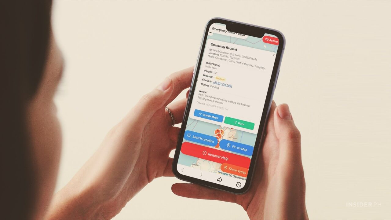
The Cebu Relief App (https://cebu-calamity-response.vercel.app/) enables victims or their relatives to pin their exact locations and specify the type of aid they need.
By consolidating this information, the app helps relief workers identify where assistance is most urgent and what form it should take, making the delivery of aid faster and more efficient.
Great minds, one mission: To help quake victims
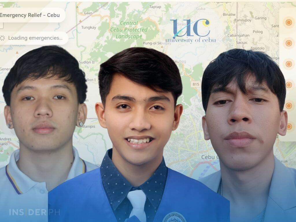
The app was developed by three young innovators—Vince Clave Igot, Ralph Adriane Dilao, and Clint Alonzo—BSIT students from the University of Cebu–Main, College of Computer Studies, who transformed their classroom knowledge into a practical tool to help earthquake survivors.
Alonzo, 22, of Barangay Ermita in Cebu City, said the idea for the app came after he saw Facebook posts from earthquake victims complaining that relief goods were not reaching them properly following the magnitude 6.9 quake that struck northern Cebu on the evening of Sept. 30.
When Alonzo shared his idea with Igot, also a 4th year BSIT student, in their group chat on Oct. 1, it turned out that they had been thinking of the same thing — a real-time app to assist earthquake victims.
Igot then invited his friend Ralph Adriane Dilao, a junior BSIT student and fellow member of the Philippine Society of Information Technology at UC, to join the project.
From idea to action in just a day
The three wasted no time, building the app and completing it the very next day. They deployed it on Vercel, a cloud platform for hosting websites and web apps, which they chose for its free hosting service.
Asked how they managed to finish the app in less than 24 hours, Alonzo replied: “Four years (studying) at UC have equipped us with the skills needed to build it.”
“(Developing the app) is our way of helping the earthquake victims,” he added.
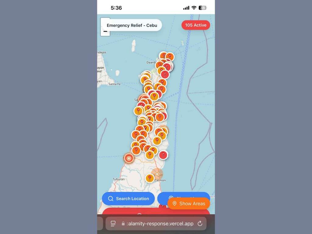
After completing the app, the group quickly uploaded its first version, which allowed victims to pin their locations and specify the assistance they need.
But some netizens noted a major limitation: power and communication lines in the quake-hit northern towns were down.
They updated the app to let volunteers and relatives pin victims’ locations. Later, another update integrated Google Maps, guiding relief workers directly to those in need.
App’s impact draws in provincial government
Alonzo said they were thrilled that the app gained traction on Facebook after being shared by several bloggers. On his own Facebook page alone, the app was shared more than 1,200 times.
As of 4 p.m. on Oct. 3, the app had logged 2,000 pinned locations. However, it still lacked a feature to show which towns had the most number of pinned locations.
Alonzo said a staff member from the Capitol reached out to meet with them at the command center on Oct. 4, as the provincial government expressed interest in using the app to speed up and streamline relief operations.
As posted by UC Chancellor Candice Gotianuy on her Facebook page, this is how to use the app:
For people in need:
For volunteers, LGUs, NGOs, and donors:
How the app works:
Contributor